9. Hog's Back Falls
Ordovician sedimentary geology and the Gloucester Fault
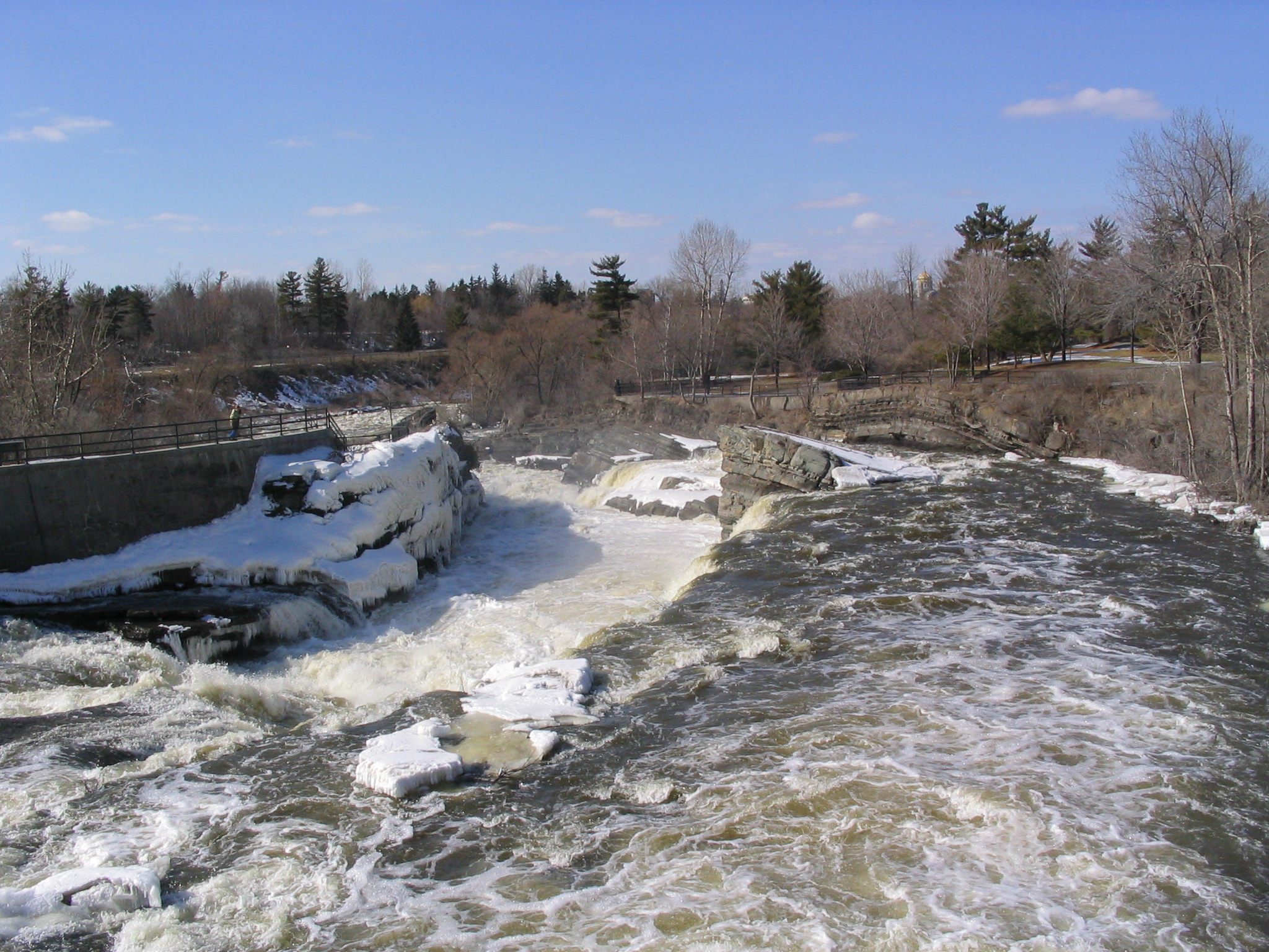
Hog's Back Falls
Hog's Back Rd. at Rideau River, Ottawa, Ont.
Hog's Back Falls. Ordovician rocks on the east side (right) are younger than the rock of the western side (left).
Photo by Q. Gall
The parking lot is east of Hogs Back Bridge. Follow the sidewalk to the falls.
From the Hog's Back Bridge where it crosses the Rideau River, by looking downriver one can get a good overview of the local geology. The rocks are sedimentary rock and Middle to Late Ordovician in age. Older rocks are on the left/west and younger on the right/east. If you stand on the pedestrian bridge and look north towards the falls, three formations are exposed; green sandstones of the Rockcliffe Formation, thin beds of shale, sandstone, limestone and dolostone of the Hog's Back Formation, and shale's, limestone's, and sandstones of the Pamelia Formation. Folding and several faults have disturbed the once horizontal sedimentary rocks, and are linked to the Gloucester Fault, a regional fault in eastern Ontario.
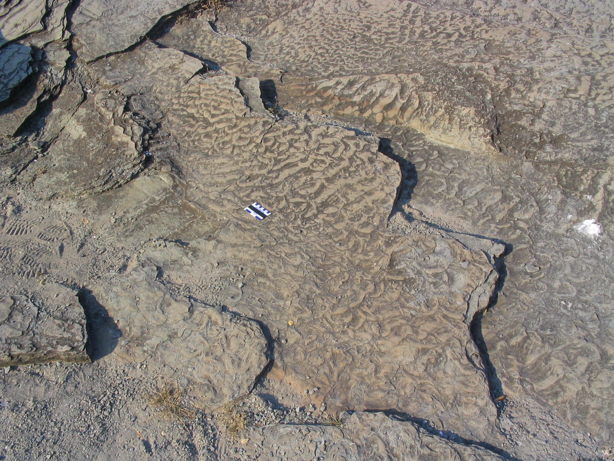
Ripple marks preserved on bedding surface, Hog's Back Falls.
Photo by Q.Gall
Rocks on the east side of the waterfall/fault have dropped down and tip away from the river. The block in the centre has broken off of the east wall and tipped to the east (assuming that all sedimentary rocks were deposited horizontally). The change with age from sandstone (Rockcliffe Formation) to various lithologies (Hogs Back Formation), and culminating in limestone (Pamelia Formation represents variation in sea level in the Ottawa basin, with a general retreat of the shoreline to the west towards and past Kanata). The three formations document three different, successive histories of deposition in the region.
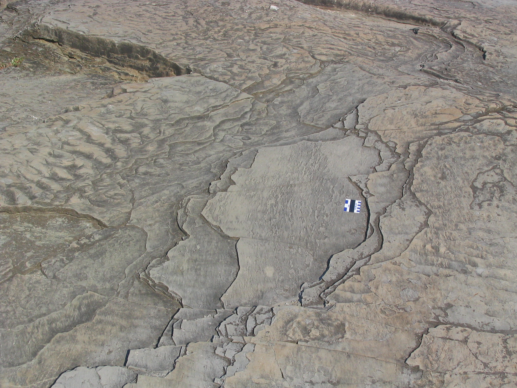
Walk down onto the observation area on the left side (west) of the falls. The Rockcliffe Formation sandstone is exposed here. The Rockcliffe Formation sandstone is fine- to medium-grained, micaceous, and the grains are cemented by calcite. This sandstone contains more feldspar and lithic grains compared to the quartz-rich Nepean Formation sandstone seen earlier. Sedimentary structures that can be seen along the west side of the falls (in the public access area) include folding, faulting, and ripple marks and bedding surfaces. Glacial polishing and striae can be seen on some parts of the surface. Striae are parallel linear scratches, eroded into the soft bedrock by pieces of hard rock, broken from the bedrock and frozen into and carried by the overriding glacier.
Looking eastward across the river, are beds of the Hog's Back Formation and, at the top of the cliff, the overlying Pamelia Formation (basal unit of the Ottawa Group). The bedding of the Hog's Back Formation is generally thinner than that of the Rockcliffe Formation, and consists of argillaceous (clay-rich) dolostone, limestone and shale. The Pamelia Formation at the top of the cliff section is comprised of bioturbated and phosphatic sandstone, shale and fossiliferous limestone beds. Exposures of the Pamelia Formation further downriver, display abundant hemispherical stromatolites and, in some outcrops, good evidence of karst weathering.
Go to the east side. The limestone beds display ripple cross-lamination and contain abundant fossils such as ostracods and bivalves and other skeletal fragments. Scattered through the more nodular limestone beds are quartz granules. The argillaceous dolostone beds contain mud cracks and phosphate-rich burrows. A small but good section of stromatolite is located at the beginning of the trail on the east side of the falls, nearest the railing. It shows a cross section of some small mounds so that the internal layering structure can be seen. Also, the limestone blocks that make up the washroom building near the parking lot contain numerous very well preserved fossils.
Walk along the river course pathway to view erosion, clusters of boulders that have been concentrated by removal of the finer-grained components of glacial till, and upstream imbrication.