Ottawa Gatineau Geoheritage

The Ottawa-Gatineau Geoheritage Project promotes greater public knowledge and appreciation of the geology and related landscapes in and around Canada's National Capital Region

16. Lac des Fées Trail, Gatineau Park

Limestones from a depositional environment of shallowing water depths


Lac des Fées Trail, Gatineau Park, Québec

Du Lac des Fées Promenade, south of Blvd. des Allumettières, Gatineau, PQ.

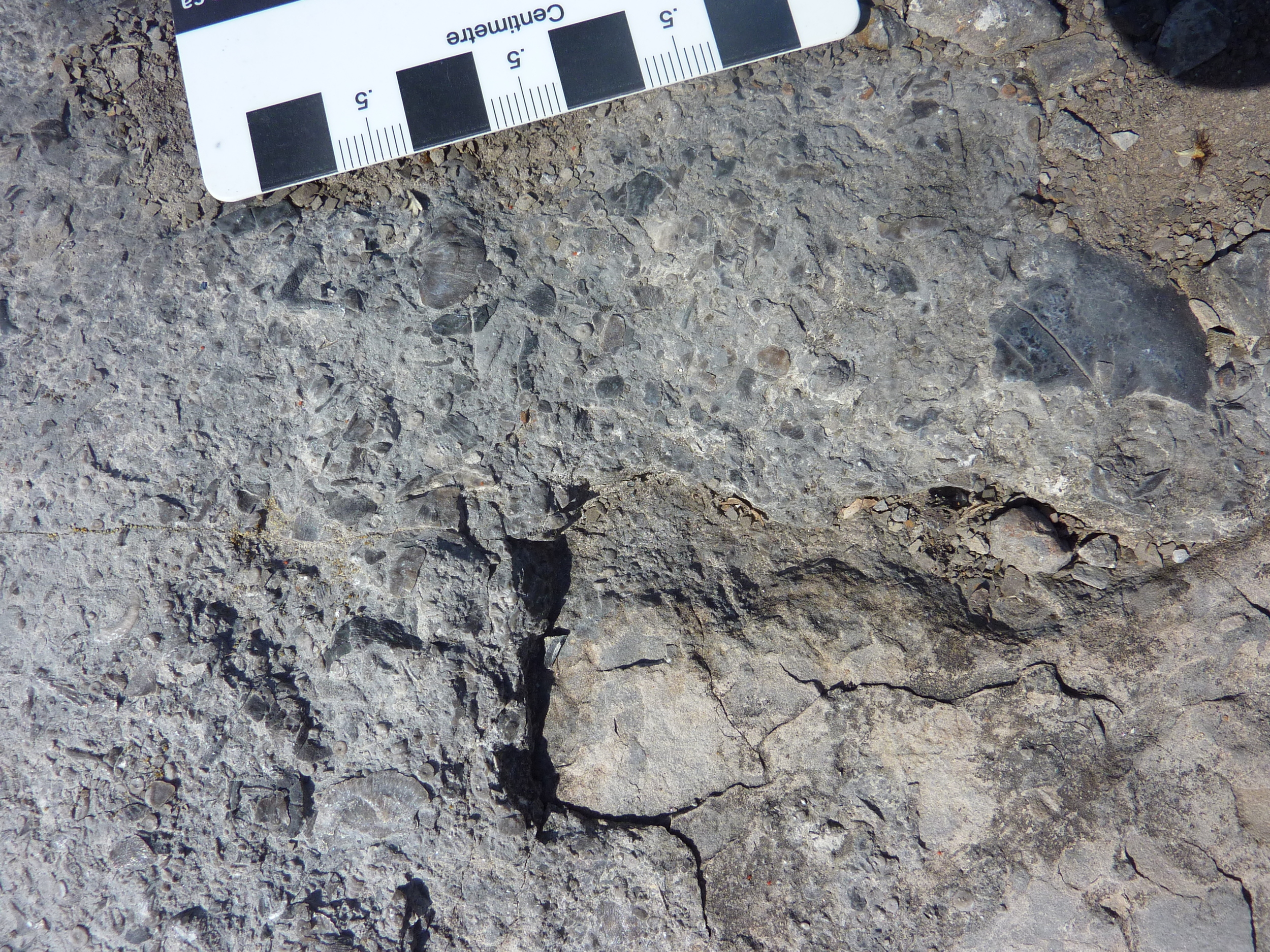
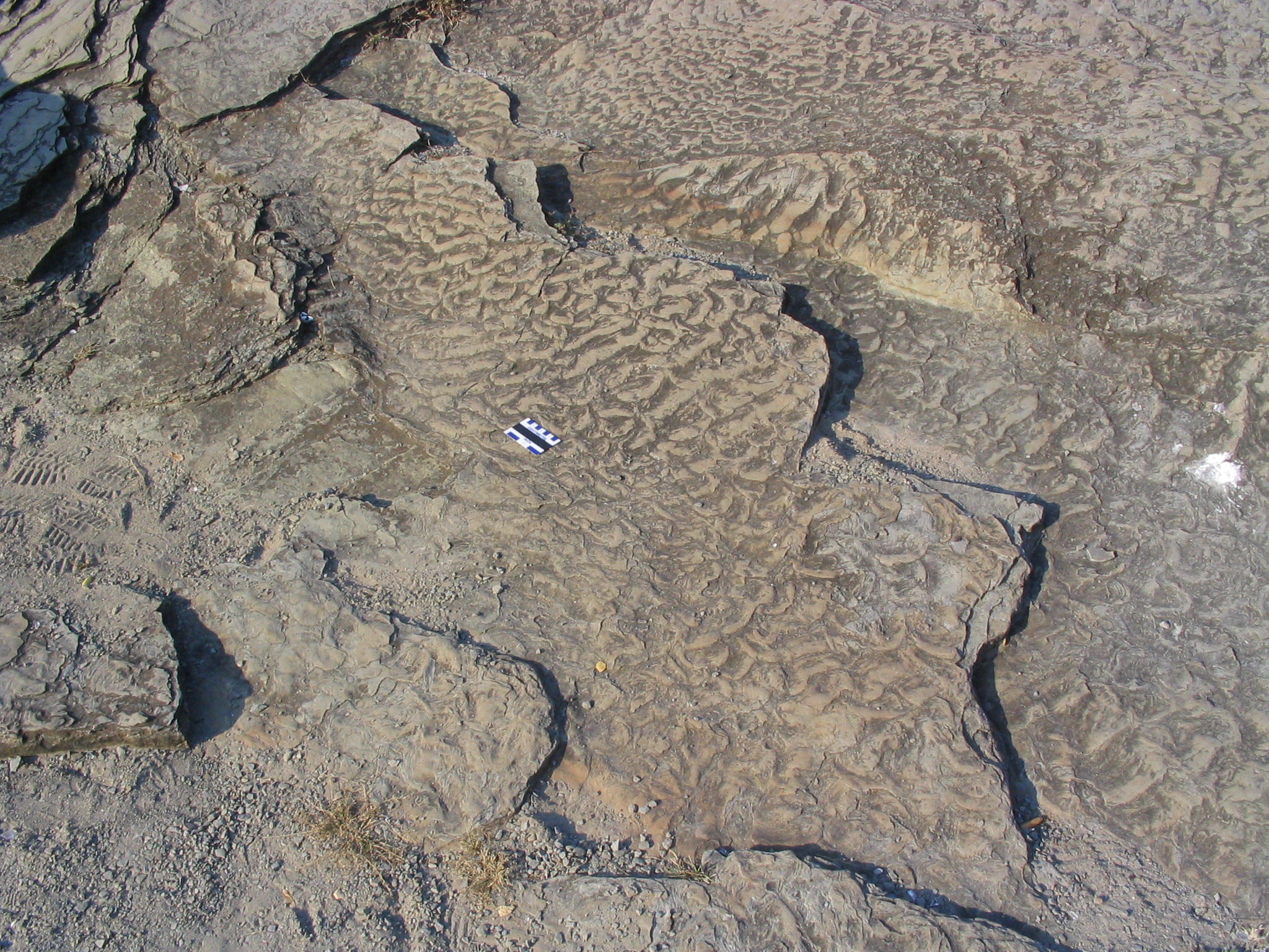
Hull Formation coarse-grained limestone characterized by cross-beds, erosive boundaries between beds, and rip-up clasts, Du Lac des Fées Promenade, Gatineau.

Photo by B. Halfkenny.

Park at the end of Rue Laramée and follow the sidewalk back down to Du Lac des Fees Promenade, south of the exit to Boulevard des Allumettières. The outcrops are on the west side of Du Lac des Fees Promenade.

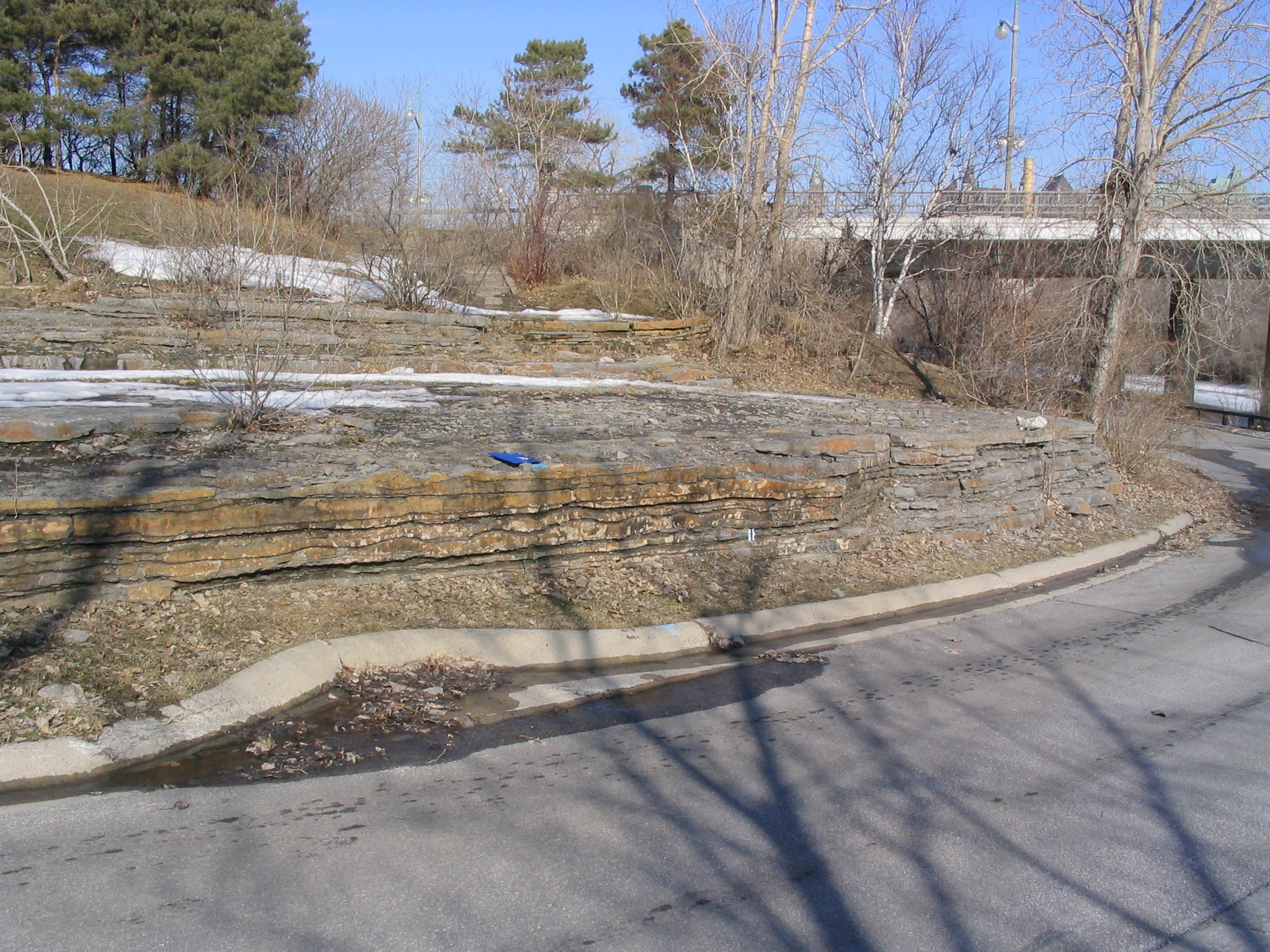
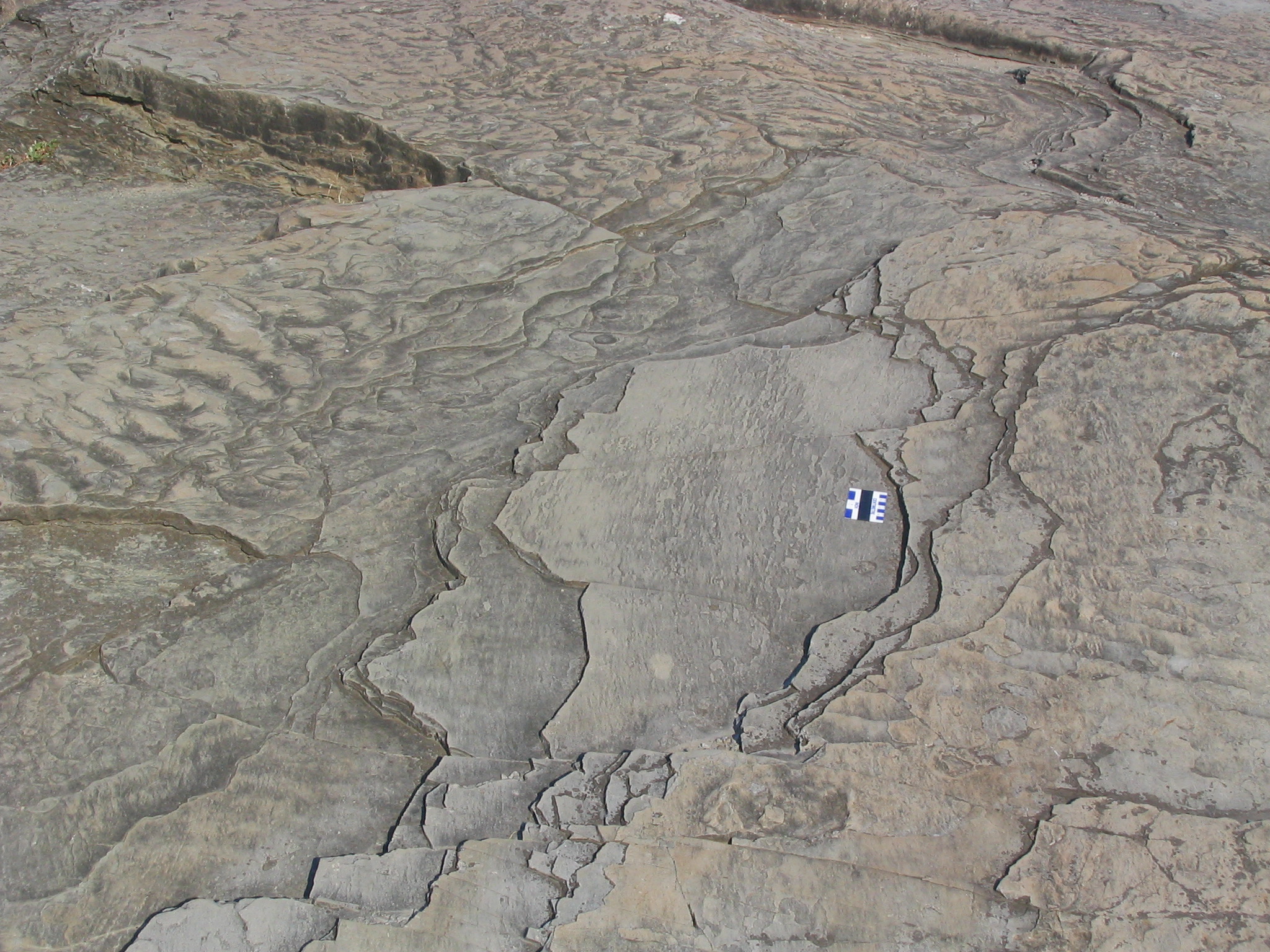
The rocks are part of the Hull Formation, of Late Ordovician age. The outcrop shows a stratigraphic division between fine-grained thin-bedded limestone separated by thin shale in the lower half (lower Hull Formation), and thicker bedded, coarser-grained limestone in the upper half (upper Hull Formation). There is almost no shale associated with the coarser-grained limestone.

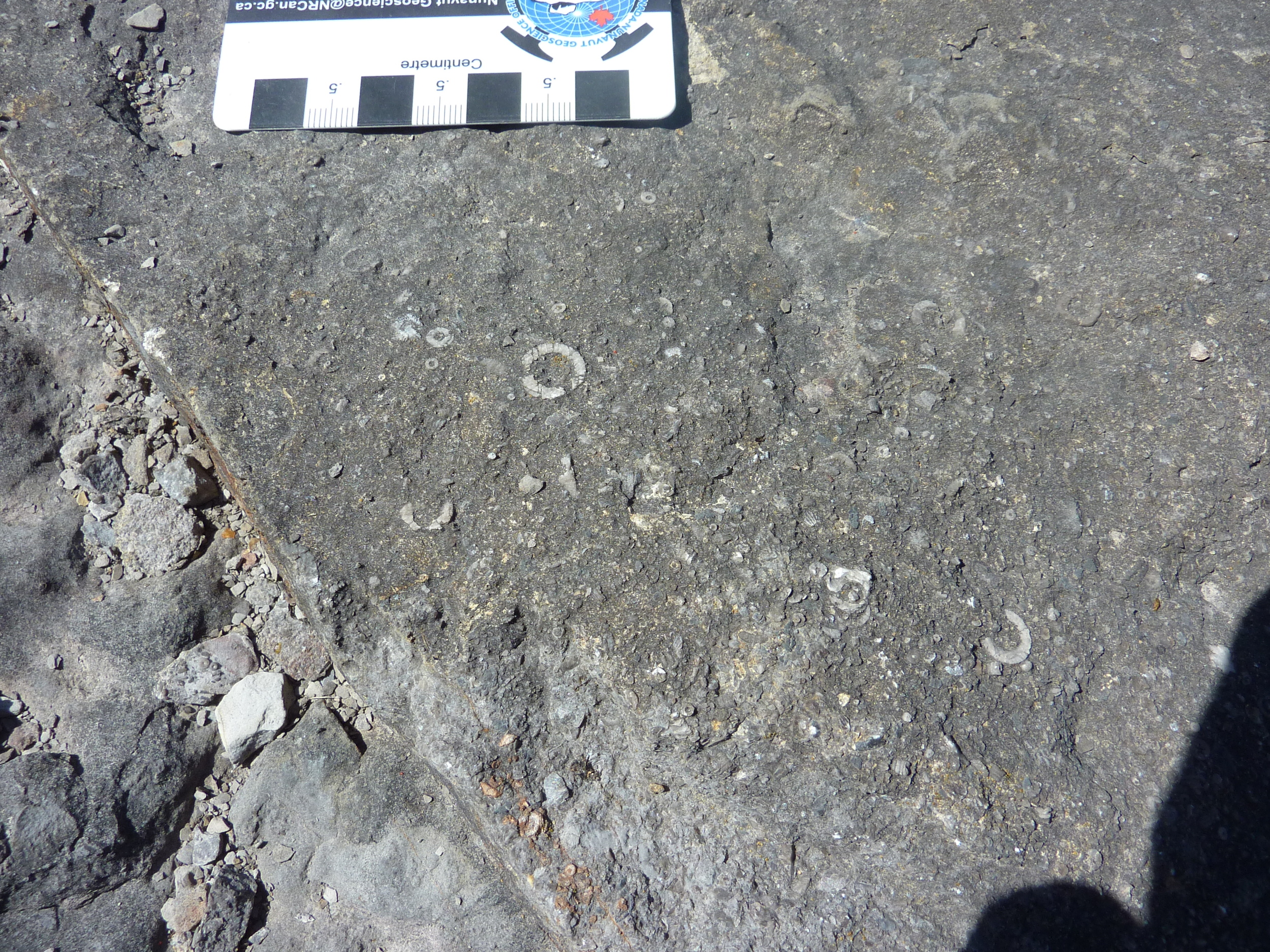
In addition, these latter rocks contain abundant sedimentary structures that indicate higher levels of energy associated with deposition: cross-beds, erosive boundaries between beds, and rip-up clasts (fragments) from an underlying bed incorporated into the overlying bed. The rip-up clasts indicate that the underlying bed was lithified prior to erosion. The granular texture of the upper limestones is due to abundant fragments of echinoderms; some beds are 100% echinoderm fragments. 

Hull Formation fine-grained thin-bedded limestone separated by thin shale in the lower half of section, Du Lac des Fées Promenade, Gatineau. 

Photo by B. Halfkenny.

Rock classification names appropriate for the upper half of the outcrop are echinoderm grainstone and skeletal rudstone; for the lower half, skeletal packstone and skeletal mudstone. These names identify contrasting energy regimes. The sedimentary structures and grain size contrast between the lower and upper part of the outcrop (and this change can be traced regionally from the Ottawa area) identifies a shallowing of water depth; the upper rocks likely accumulated in water depths of less than 10 m. The presence of echinoderms indicates normal seawater salinity.

The Hull Formation is an important source of building stone in Ottawa and Gatineau.
15. Cantley Quarry, Québec

Outcrops of Precambrian marble shaped in part by sub-glacial hydraulic scouring


Quarry, near Cantley, Québec

3 km north of Cantley on Hwy 307, PQ.

Precambrian marble sculpted by hydraulic scouring under glacial ice, Cantley, Québec.

Photo by B. Halfkenny.

This site is an excellent spot for contemplating relative geological history and the challenges geologists face in the field when trying to piece together what has happened to create this particular configuration of rock.

The outcrop consists of Precambrian Grenville marble, in places topped by Holocene glacial sediments. There is a difference of almost 1 billion years between the marble and the sediments on top; this is called an unconformity - we have no record of the intervening time. The outcrop itself shows both brittle and ductile deformation; the marble would have originally been layers of limestone which behaved in a plastic way when confronted with metamorphic forces of heat and pressure, flowing around what were once more brittle silica-rich layers of shale or igneous intrusions. These more brittle rocks would have broken with the stress, and been moved and incorporated within the more ductile rock to produce the features we see now.

The unusual sculptured shape of the outcrop is the result of hydraulic scouring by debris carried in subglacial meltwater moving under high pressure.The rock surfaces also show glacial striae (parallel linear scratches).

14. Champlain Lookout, Gatineau Park

Precambrian bedrock, Eardley Fault escarpment and a fabulous view of the Ottawa valley


Champlain Lookout, Gatineau Park, Québec

West end of Promenade Champlain, Gatineau Park, PQ.

View to west from Champlain Lookout, Gatineau Park.

Photo by B. Halfkenny.

This location provides a magnificent overview of the Ottawa Valley (Ottawa-Bonnechere Graben).

The retaining wall of the Champlain Lookout is built from Precambrian rocks found within the park and provides a vantage point to view the Ottawa-Bonnechere Graben, a rift valley considered to represent a failed arm of the Iapetus Ocean, the precurser to the Atlantic Ocean. The information plaques at the site provide an overview of the geological history of the National Capital Area.

The Champlain Lookout sits atop the Eardley escarpment, assumed to be an extension of the Eardley Fault system, which developed about 175 million years ago. Sedimentary rocks of Paleozoic age were preserved in the down-dropped block of the Ottawa Valley, while equivalent rocks have been removed by erosion on this side of the fault. Here, Precambrian rocks are exposed.

The flat-lying sedimentary rocks in the valley are covered by unconsolidated sediments deposited during and after the last Ice Age when, first, glaciers moved across the country and then the cold Champlain Sea flooded the lowland and thick deposits of silt and clay were laid down.

13. Victoria Island

Dune bedforms and fossiliferous limestone


Victoria Island

Middle Street, on Victoria Island, as it passes under Portage Bridge, Ottawa. Access from Chaudières Bridge.

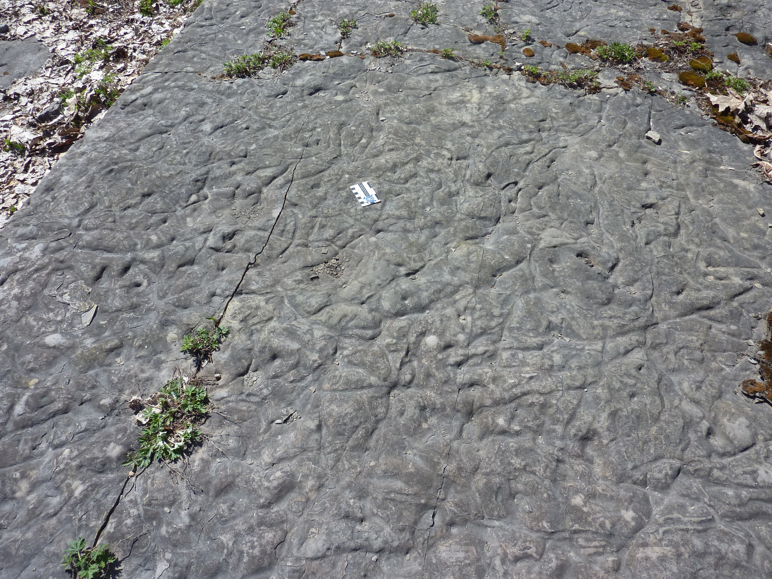
Undulating dune bedforms in Ottawa Group limestone, Victoria Island, Ottawa. 

Photo by Q. Gall.

These outcrops are Ottawa Group fossiliferous limestone, which contain dune-scale bedforms (megaripples; >4 cm amplitude). The vertical section of the outcrops on either side of the road, show alternation between limestone beds containing abundant fossil fragments (brachiopods, bryozoa, orthocone cephalopods and crinoids) and dunes, and limestone beds that are flat-lying and contain abundant feeding burrows and trails (trace fossils). Crossbedding and stylolites (non-structural fractures) are locally prominent, as are desiccation cracks.

One interpretation of the bedding style alternation may be that it reflects environment changes between stormy periods (sediment and fragmented fossil transportation by dunes along the sea floor) and calmer, 'fair weather' periods with little sediment transportation and more feeding by benthic animals. Occasional mudcracks in the vertical section indicate periodic exposure, resulting in desiccation of the limy sediment. It is also possible that the changing character of the limestone beds reflects periodic rising (deepening) and falling (shallowing) of sea level. The beds that are rich in trace fossils and few dunes, may reflect a deeper water quiet environment that was below normal 'fair weather' wave base.

12. Parc Brébeuf, Gatineau

Fossiliferous limestone bedrock and glacial erratics


Parc Brébeuf, Gatineau

Rue Begin at Rue Bourget, Gatineau, PQ.

Note: Do not collect fossils.

Cephalopod, lowermost beds along shore of Ottawa River, in Parc Brébeuf, Gatineau.

Pebbles and crushed stone have been arranged in distinctive patterns in the walkways around the Brébeuf statue. The tapered base of this statue contains at least 500 cobblestones that are representative of the many rock types (mainly igneous and metamorphic) within the Grenville Province. The clean polished surfaces of these cobbles, rounded and smoothed by abrasion during transportation by glacial ice and meltwater before deposition in a gravel pit, provide an opportunity to study the mineralogy, textures and structures (foliation, lineation, intrusive contacts) typical of Precambrian terrane to the north.

Beds of Ordovician Limestone of the Ottawa Group are well exposed along the river shoreline. These strata contain abundant corals, stromatoporoids, cephalopods, gastropods, mollusks, brachiopods, bryozoa, rare small fragments of trilobites and trace fossils (evidence, without the body, of animal or plant activity). Limestone blocks in the retaining walls provide fine examples of the range of textures in clastic limestones: from fine- to very coarse-grained calcarenite. Primary structures include bedding, crossbedding, ripple marks (symmetric, asymmetric and interference ripple marks) and desiccation cracks.

Stratigraphy - some fossil assemblages are restricted to certain beds, reflecting marked changes in depositional environment. The lowermost limestone beds, exposed to the west along the shore of the Ottawa river, contain abundant mollusks, bryozoa and scattered patches of brachiopods. Overlying beds present excellent displays of Tetradium (tabulate coral). The next distinctive unit presents a profusion of mushroom-shaped stromatoporoids and tabulate corals, many detached and jumbled, recording a major storm event. Trace fossils in association with branched bryozoa characterize the uppermost beds of this 4-metre-thick section. These traces, abundant through at least 1.5 metres of limestone below the stone retaining walls, show a wide variety of patterns and geometries, with resemblances to numerous trace fossils such as Chondrites, Palaeophycus, Phycodes, Planolites and Thalassinoides.

Secondary structures include joints (fractures) and stylolites (non-structural fractures); these prominent features are accentuated by weathering. Several of the large stone steps, in the most westerly walkways down to the shore, display small hemispherical colonies of tabulate corals and byrozoa (Prasopora?).

Walk eastward to a large boulder of Precambrian gneiss marking the Voyageurs Portage. This boulder shows excellent folded foliation in three-dimensions, providing an example of the style of deformation that is characteristic of the Grenville Province. Immediately north, Rue Bourget has a curb along the south side consisting of two to three rows of stone paving blocks. Most are Nepean sandstone (set both on edge and parallel to bedding), but igneous rocks are also represented, including granite, syenite and diorite. Some sandstone blocks display Liesegang banding, and most are deeply iron stained (some may have been derived from the abandoned quarry at Lac Beauchamp ). Walk back along Rue Bourget to the parking area, proceeding east along the bike path (look out for speeding cyclists and rollerbladers). Just beyond the northeast fenced corner of the transformer station, take the last gravel footpath to the east (just before the T- junction in the bike path) out to the south shore of a small inlet on the Ottawa River. Excellent views of folds in limestone beds can be seen along the northeastern shore of this inlet.

11. Lemieux Landslide

Leda Clay landslide along South Nation River

Lemieux Landslide

County Road 16 at Concession Rd. 14, The Nations Municipality, Ont.

Lemieux Landslide, taken 4 days after the event. The South Nation River has risen 12 m, flooding into the scar. The river is about to overtop the landslide dam at the bottom of the photo.

Photo by S. Evans

Park at the intersection of Regional Road 16 and Concession 14. Walk north along the open trail to the headscarp of the Lemieux landslide. The best views are from the opposite side of the landslide. It is easier to walk around the headscarp than to attempt to cross the scar.)

The 20 km stretch of valley of the South Nation River downstream of Casselman is the most active landsliding region in Ontario. This section of the river is entrenched in a deep (~25 m) valley incised through deltaic sand into the underlying sensitive marine clay informally known as Leda Clay. A large retrogressive earthflow occurs here, on average, every 20 to 25 years. Following a major earthflow in 1971, geotechnical testing along the South Nation River led to the identification of the town of Lemieux as lying within a zone of potential highly retrogressive failure. As a result, Lemieux was abandoned in 1991 and residents were relocated. In 1993, only two years later, a large earthflow consumed 17 hectares of farmland adjacent to the former town site.

The failure began at the river bank, possibly as a small slump. Significant loss of strength and liquefaction of the clay in the most sensitive zone (which lies 20 to 30 m below the surface and even with the level of the river) caused this initial failure to develop into a rapid earthflow. The initial liquefaction ultimately caused most of the overlying silt and clay to also liquefy and flow. The stiffer surface sediments were fractured and carried as rafted blocks on the flow of remolded clay.

In less than 1 hour (and in under 15 minutes for the most part), the Lemieux earthflow rapidly ate back 680 m into the surrounding plain, severing a highway. The landslide also widened, creating embayments into both the north and south sidewalls. The lateral extent of the failure seems to have been restricted by the presence of nearby deep ravines lying to the north and south of the landslide. These ravines probably allowed sufficient drainage of their immediate area to prevent failure.

About 2.8 million cubic metres of debris flowed into the river valley, extending 1.6 km upstream and 1.7 km downstream of the crater mouth and completely damming the South Nation River for 4 days. Initially, upstream water levels were raised 12 m above normal, and elevated levels were maintained for well over a year.

Since 1993, frost action, precipitation, and revegetation have subdued the scar surface. The river has cut down into the debris in the valley and a deep gully now extends from the river into the scar. The steep headwall at the top of the landslide has been graded and smoothed to increase stability.

The local township estimates that direct costs of this event are $4 million; if indirect costs are included, the estimate is $12.9 million.

10. Mer Bleue Bog

Boreal peatland in abandoned channel of early Ottawa River

Mer Bleue Bog

East end of Ridge Rd., Ottawa, Ont.


Air photo showing the areal extent of Mer Bleue Bog with the interpretive trail shown in blue.

Mer Bleue lies on the floor of an ancient river channel, informally called the Mer Bleue channel, which was cut into the unconsolidated sediments of the postglacial Champlain Sea about 9000 years before present by the Ottawa River. These sediments consist of thick (25-100 m) deposits of marine clay and clayey-silt (informally called Leda Clay) capped by a sand delta.

During the last ice age, the weight of the glaciers depressed the surface of the earth. As the glaciers began to melt away from this area about 12000 yrs BP, the Atlantic Ocean invaded the Ottawa and St. Lawrence River valleys, creating a temporary sea - the Champlain Sea. Vast amounts of clay were deposited in this sea. As the land surface slowly rose to its current elevation, the Sea retreated and the Ottawa River and its tributaries began to erode broad valleys into the sediment of the sea bottom. At this time, swollen by glacial meltwater, the early Ottawa River was much larger than today and occupied many channels. Most channels were abandoned about 8000 yrs. BP, when river discharge drastically dropped after Hudson Bay became ice-free. Since abandonment, peat has accumulated in Mer Bleue Bog to thicknesses of up to 6 metres. A radiocarbon age of 7650 yrs. B.P. from basal peat established the age of the bog.

The impermeable nature of the clay that underlies a depression in the channel floor accounts for the slow accumulation of peat forming the bog. The western side of the bog is characterized by 3 long arms divided by long narrow sand ridges that were deposited by the early Ottawa River. Anderson Road traverses these arms of the bog and sand ridges. Excellent signage describing the geological history is available near the boardwalk parking lot at the end of Ridge Road.

Mer Bleue Bog is one of the largest bogs in southern Ontario. It is a remarkable boreal-like ecosystem normally found in the far north. Interpretive signs along the boardwalk guide you through the development and biology of a bog.

The following flora description is reprinted from Mer Bleue Conservation report 

http://www.wetlands.org/reports/ris/4CA033en.pdf .

Mer Bleue is a boreal peatland which is usually found in the boreal forest to the north. The sphagnum bog contains two main types of vegetation - the black spruce forest and the open heath vegetation. The black spruce (Picea mariana) forest is dominated by the black spruce and some larch (Larix laricina), trembling aspen (Populus tremuloides) and grey or white birch (Betula spp.) Sphagnum spp. are the dominant low lying form of vegetation in the bog. About 12 species of heaths thrive in the bog. The most common being Labrador tea (Ledum groenlandicum), leatherleaf (Chamaedaphne sp.), small cranberry (Vaccinium oxycoccus), bog-laurel (Kalmia prolifolia) and sheep-laurel (K. augustifolia). At least nine species of orchids (Orchidaceae spp.) are found in Mer Bleue along with a variety of cottongrasses (Eriophorum spp) and sedges (Cyperaceae spp.). The marsh areas around Mer Bleue are characterized by plants such as cattails, alders (Alnus rugosa), willows (Salix sp.) and sedges (Cyperaceae spp.). There are several aspen islands in the centre of Mer Bleue consisting of an overstory of aspen and an understory dominated by bracken fern.

9. Hog's Back Falls

Ordovician sedimentary geology and the Gloucester Fault

Hog's Back Falls

Hog's Back Rd. at Rideau River, Ottawa, Ont.

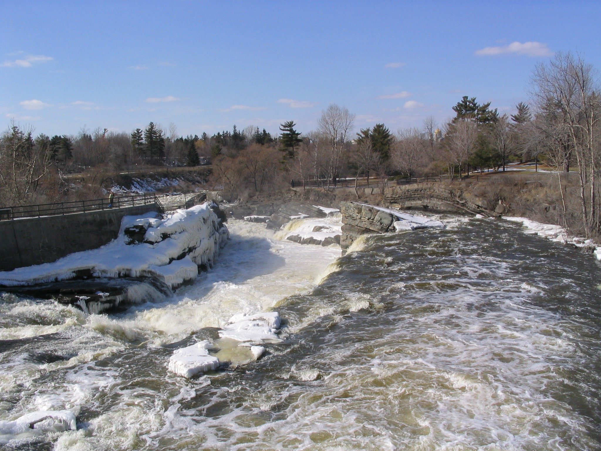
Hog's Back Falls. Ordovician rocks on the east side (right) are younger than the rock of the western side (left).

Photo by Q. Gall

The parking lot is east of Hogs Back Bridge. Follow the sidewalk to the falls.

From the Hog's Back Bridge where it crosses the Rideau River, by looking downriver one can get a good overview of the local geology. The rocks are sedimentary rock and Middle to Late Ordovician in age. Older rocks are on the left/west and younger on the right/east. If you stand on the pedestrian bridge and look north towards the falls, three formations are exposed; green sandstones of the Rockcliffe Formation, thin beds of shale, sandstone, limestone and dolostone of the Hog's Back Formation, and shale's, limestone's, and sandstones of the Pamelia Formation. Folding and several faults have disturbed the once horizontal sedimentary rocks, and are linked to the Gloucester Fault, a regional fault in eastern Ontario.

Ripple marks preserved on bedding surface, Hog's Back Falls.

Photo by Q.Gall

Rocks on the east side of the waterfall/fault have dropped down and tip away from the river. The block in the centre has broken off of the east wall and tipped to the east (assuming that all sedimentary rocks were deposited horizontally). The change with age from sandstone (Rockcliffe Formation) to various lithologies (Hogs Back Formation), and culminating in limestone (Pamelia Formation represents variation in sea level in the Ottawa basin, with a general retreat of the shoreline to the west towards and past Kanata). The three formations document three different, successive histories of deposition in the region.

Walk down onto the observation area on the left side (west) of the falls. The Rockcliffe Formation sandstone is exposed here. The Rockcliffe Formation sandstone is fine- to medium-grained, micaceous, and the grains are cemented by calcite. This sandstone contains more feldspar and lithic grains compared to the quartz-rich Nepean Formation sandstone seen earlier. Sedimentary structures that can be seen along the west side of the falls (in the public access area) include folding, faulting, and ripple marks and bedding surfaces. Glacial polishing and striae can be seen on some parts of the surface. Striae are parallel linear scratches, eroded into the soft bedrock by pieces of hard rock, broken from the bedrock and frozen into and carried by the overriding glacier.

Looking eastward across the river, are beds of the Hog's Back Formation and, at the top of the cliff, the overlying Pamelia Formation (basal unit of the Ottawa Group). The bedding of the Hog's Back Formation is generally thinner than that of the Rockcliffe Formation, and consists of argillaceous (clay-rich) dolostone, limestone and shale. The Pamelia Formation at the top of the cliff section is comprised of bioturbated and phosphatic sandstone, shale and fossiliferous limestone beds. Exposures of the Pamelia Formation further downriver, display abundant hemispherical stromatolites and, in some outcrops, good evidence of karst weathering.

Go to the east side. The limestone beds display ripple cross-lamination and contain abundant fossils such as ostracods and bivalves and other skeletal fragments. Scattered through the more nodular limestone beds are quartz granules. The argillaceous dolostone beds contain mud cracks and phosphate-rich burrows. A small but good section of stromatolite is located at the beginning of the trail on the east side of the falls, nearest the railing. It shows a cross section of some small mounds so that the internal layering structure can be seen. Also, the limestone blocks that make up the washroom building near the parking lot contain numerous very well preserved fossils.

Walk along the river course pathway to view erosion, clusters of boulders that have been concentrated by removal of the finer-grained components of glacial till, and upstream imbrication.

8. Geological Survey of Canada, 601 Booth St.

Ottawa Group Fossiliferous limestone

Geological Survey of Canada

601 Booth St., Ottawa, Ont.

Fossiliferous limestone (Ottawa Group, Cobourg-Lindsay formations) at the headquarters of the Geological Survey of Canada, 601 Booth St., Ottawa.

Photo by Q. Gall.

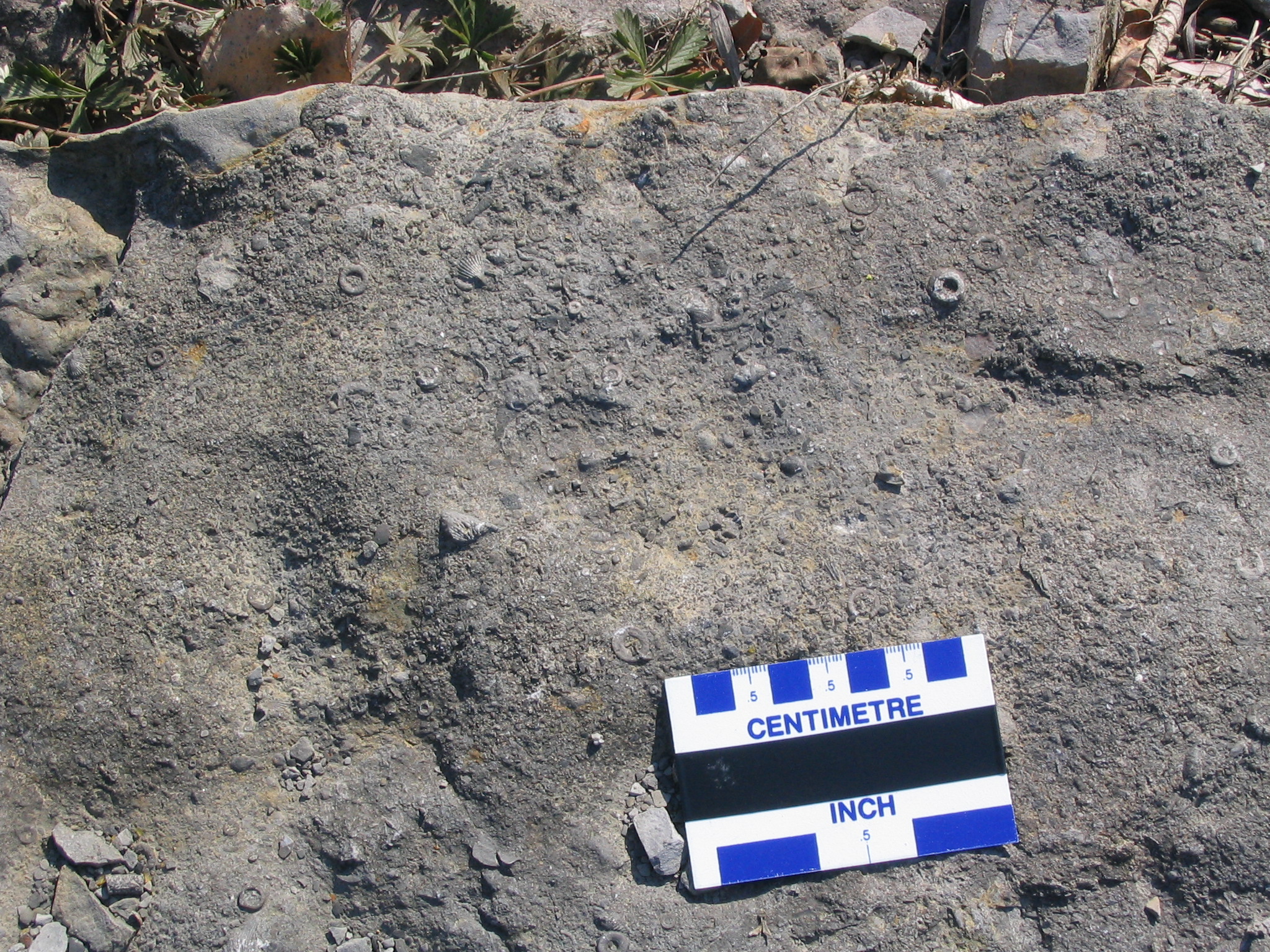
The rock outcrop exposed in front of the head office of the Geological Survey of Canada building is from the Lindsay Formation of the Ottawa Group. This grey limestone is exposed on the edge of the Gloucester Fault splay and contains brachiopods, corals and crinoid stems interspersed on different layers of the limestone. Each layer shows the ancient ocean floor with extensive bioturbation with trace fossils evident on most layers. Trace fossils are evidence of biotic activity without the actual body of the plant or animal (for example, burrows, tracks, etc.)

This outcrop of rock was preserved by the effort of Alice Wilson, the GSC's first female geologist and the person who first mapped the geology of the Ottawa region.

During the work day, you can visit the museum in Logan Hall, 601 Booth St., to see a fine collection of minerals, rocks, fossils and meteorites.

7. Tunney's Pasture

Gloucester Fault

Tunney's Pasture

Scott St., west of Parkdale Ave., Ottawa, Ont.

Park on the south side of Scott St., cross to the north side, about 80 m west of Parkdale, and look through the fence to the opposite wall of the transitway

Section of the Gloucester fault splay at Tunney's Pasture showing the displacement across the fault.

Photo by J. Aylsworth

The OC Transpo western transit way shows excellent exposures of the Ordovician bedrock in the region. Along Scott St. near the Tunney's Pasture entrance on Parkdale Ave. the Gloucester Fault can be seen through the fence. Look for the statue of a large hand. Faults are breaks in the bedrock. Frequently faults are areas of weakness where erosion will occur. Throughout the transit way many of these eroded areas are unstable so they have been cemented over to re-enforce and stabilize the faulted rock. However, parts of the fault spray are still visible here. The upturned layers on the east side of this break indicate that the eastern block has moved downward with respect to the west side. There is actually 30 m of vertical displacement here. There are different rocks on either side of this fault. The Gull River Formation is found on the west side: the Bobcaygeon Formation on the east. Both belong to the Ottawa Group.